The Lower Mississippi River Water Trail
Alternate Route to the Gulf of Mexico: the Atchafalaya River
So now a little over three hundred miles from the Gulf, the Mississippi brings you to its first possible distributary channel to get there, which by the way cuts the distance in half. Paddlers headed for the Gulf of Mexico are here afforded a wonderful alternate route down the “River of Trees,” the Atchafalaya River. It’s the route the river wants to take. You could just as easily go with the flow and follow along.
Here’s the choice: 1) Mississippi River — 300 miles of industry or 2) The Atchafalaya River — 150 miles of wilderness. I know this is a difficult choice. Especially if you had your heart set on the traditional route. Yes, you’ll miss New Orleans on the Atchaf’. But it will be a lot safer and potentially a much more rewarding river experience. Keep in mind, you can always drive back to New Orleans and enjoy the music and food on your way home after reaching the Gulf following the Atchaf. On the other hand, you may not ever have an opportunity like this to paddle down through one of the most spectacular biotas in the world. I personally have paddled both. I and the Rivergator team of experts recommend taking the Atchafalaya. If you are on the fence about which route to follow, go with the Atchaf. Keep reading below for the reasons why.
Every thousand years or so the Mississippi River jumps its banks and seeks a new route to the ocean. Bayou Teche, Bayou La Fourche, and Bayou des Allemands are all old river channels for ancient exits of the river. The Mississippi is overdue for a new route, and it seems to favor the Atchafalaya. But New Orleans and Baton Rouge would be left dry. And so the Control Structures allow some to go the way the river wants to go, but not all of it. For paddlers, this is an excellent opportunity to go the way of the river, not the way of man’s greed and ambitions.
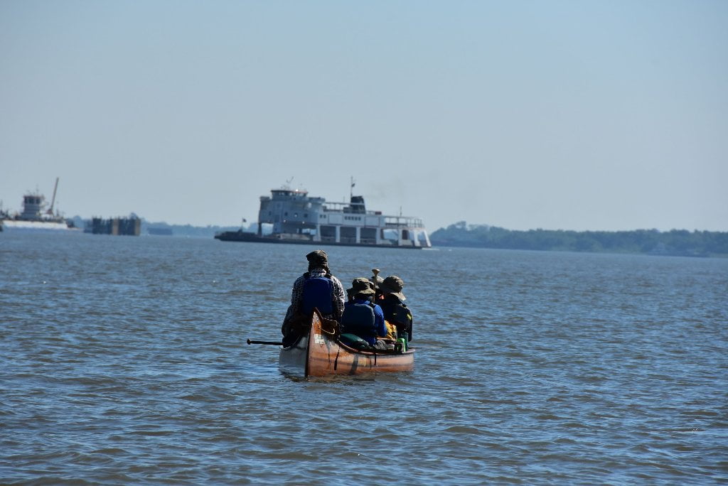
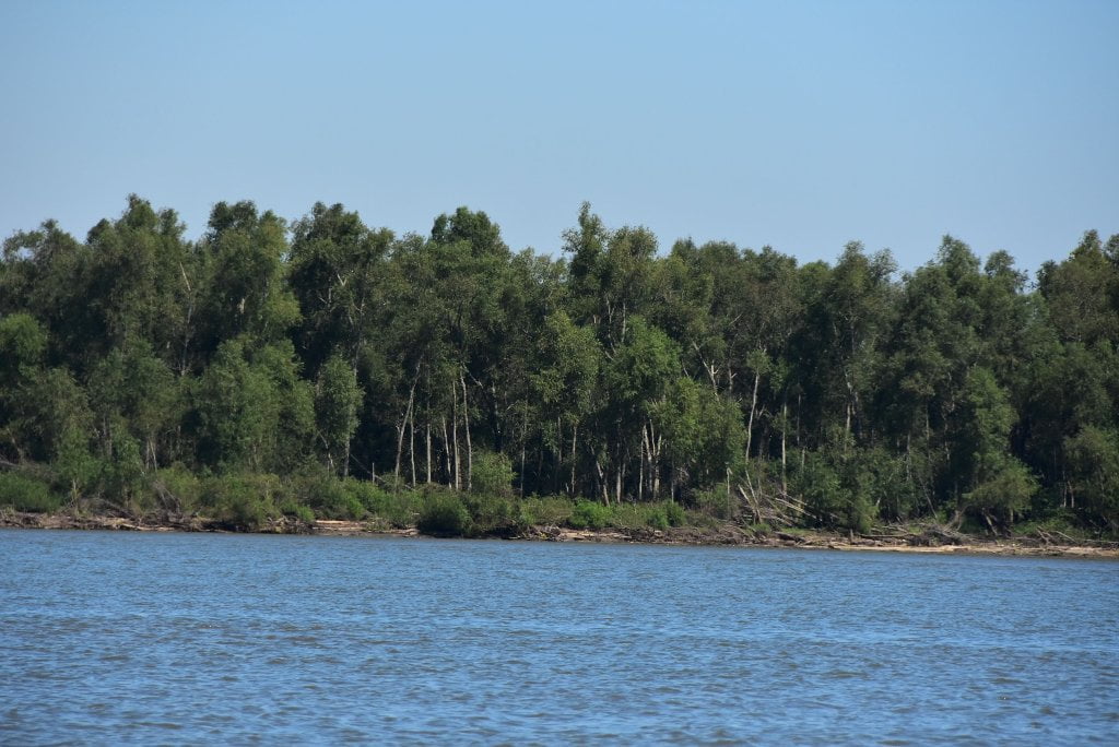
Gulf-bound paddlers can follow the Atchafalaya Exit through the biggest river swamp in America, also known as the “River of Trees” for a superlative experience in one of the most prolific wetlands in North America. Take your choice here: the wild Atchafalaya or the very industrious (and dangerous) Mississippi. If you have enjoyed the wild places on the Mississippi, and don’t care much for more busy places with more power plants, more grain elevators and more scrap steel mills, the Atchaf’ would be the most beautiful completion of your epic adventure down the biggest river in North America. The neat thing is, it’s still the same water! The Atchaf’ is the Mississippi! Going down the Atchaf’ does not mean leaving the Mississippi. It means following the route the Mississippi wants to go (more on that later). In fact, approximately 30% of the Mississippi is allowed to flow down the Atchaf’ through one of the canals you are about to pass.
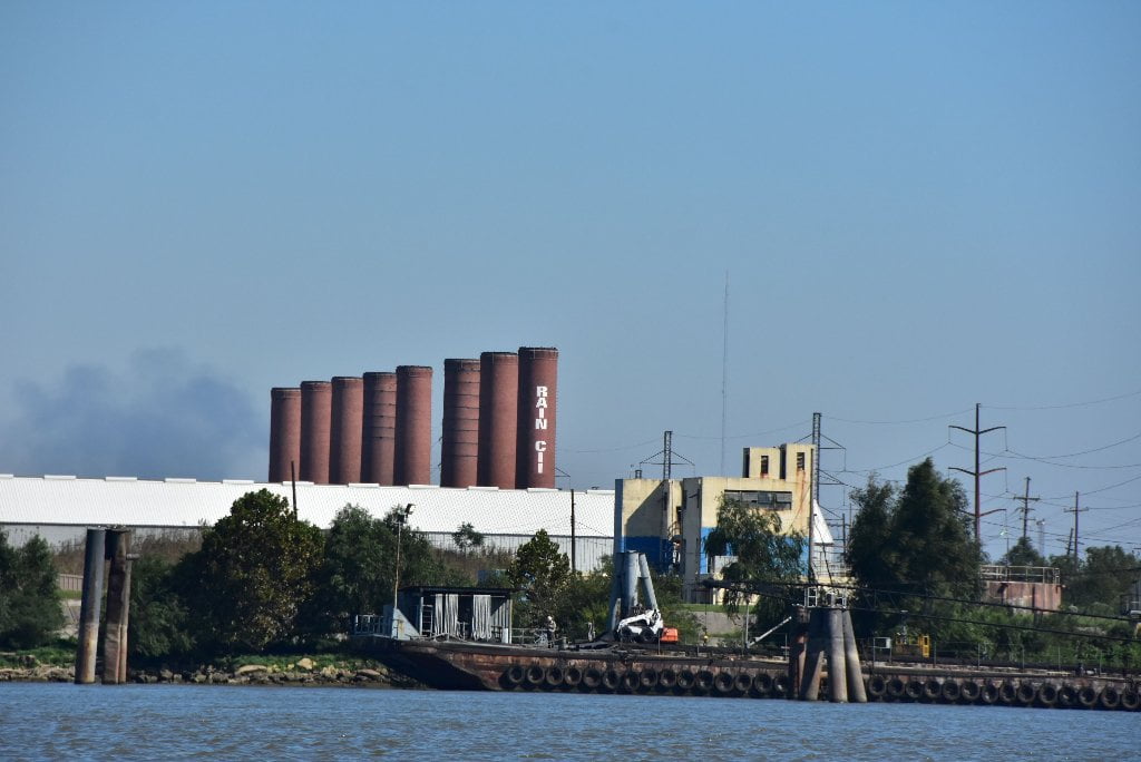
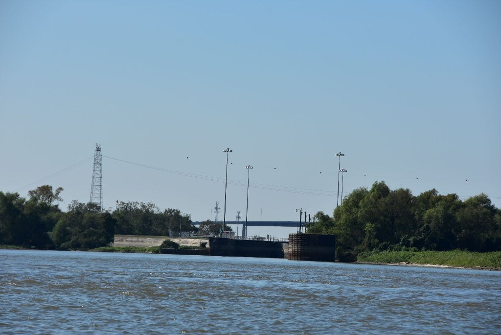
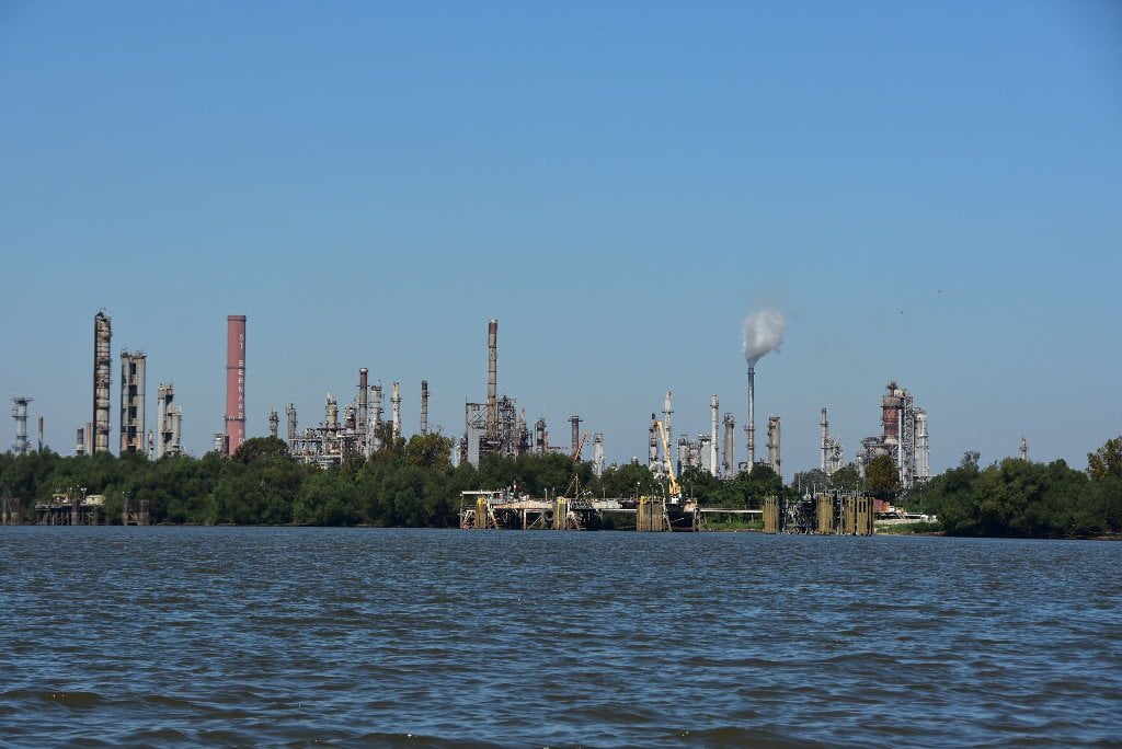
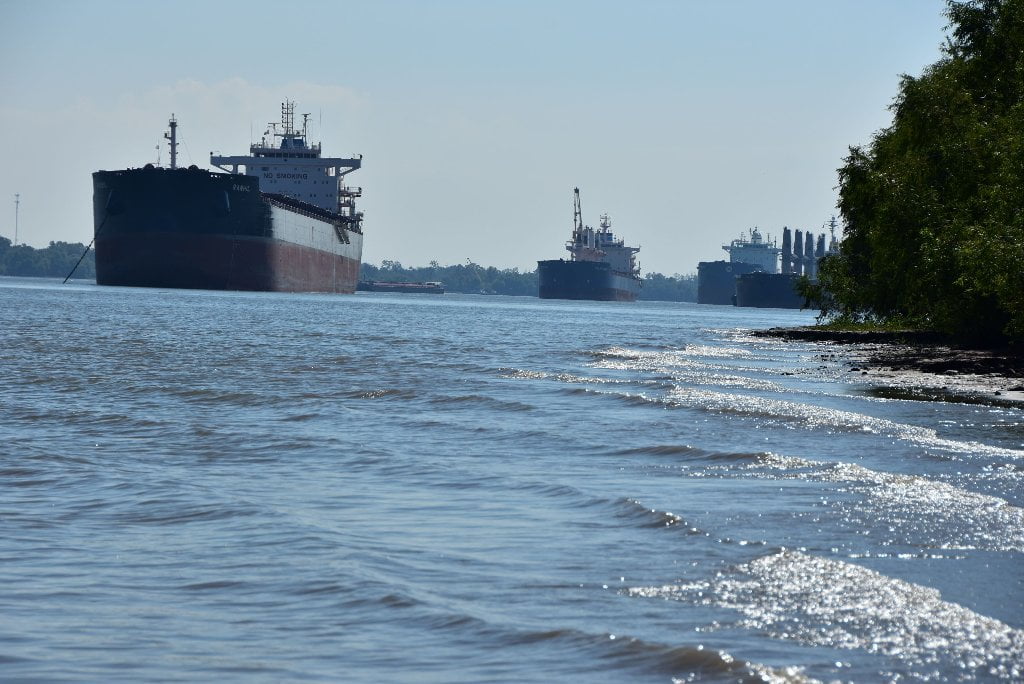
Staying on the Mississippi you will soon encounter very dangerous river conditions through Baton Rouge, New Orleans and Venice (including poor campsites with toxic air and water conditions). You will have to paddle several hundred miles of choppy crowded water sharing the main channel with sea-going freighters, cargo boats, re-supply vessels, and endless fields of barges as they fleet up for the long distance journey back up the river. Commonly known as “Chemical Corridor,” but also described as “Cancer Alley,” paddlers might want to add an oxygen face mask to their equipment list here and maybe a haz mat suit. Seriously. Some paddlers have gotten sick within this stretch when they ended up downwind of the wrong smokestack. You will be camping next to refineries, chemical plants, plastics manufacturing, and lots of coal-fired power plants. More toxins are dumped in the river here than any other piece of river in America. No more remote camping, no more swimming, no more quiet sections of river teeming with wildlife. This is a section of the Mississippi you paddle just to get through it.
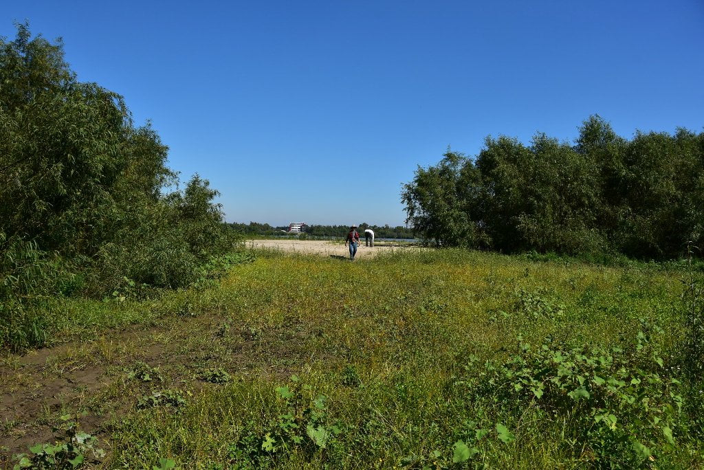
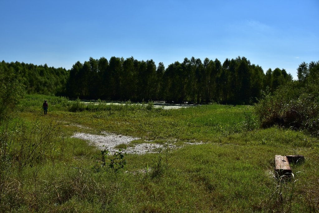
Paddlers should consider taking the Atchafalaya River through its paradise of three distinct biotas: 1) the variegated bottomland hardwood forests, 2) the cypress/tupelo gum swamps, and 3) the marshy coastal plains. It also coincides with the heart of Cajun country. To be sure, it’s not completely wild. To be sure, there are some pipelines, and a few small refineries; there are a few oil storage and processing installations; there are a few small communities to paddle through and a few bridges to go under. But they are few and far in between. There is very little sign of mankind and a lot of forests, swamps, lakes, bayous and back channels. The sky is uncluttered by cranes and powerlines, and the stars are bright at night. Baton Rouge and New Orleans are a distant glow on the horizon after dark. There is very little commercial traffic, and no giant tows with big waves. Tows here are limited to 2×3 barges maximum. But there are a lot of hunters and fishermen. The Atchafalaya is populated with Cajun river rats and hunting camps, and so it is a lived-in kind of wilderness, kind of like the Barranca del Cobre region of the Northern Sierra Madres, or the Navajo country of the Four Corners, very similar to the Lower Mississippi in days gone by, which was also thinly populated along its banks by all types of pioneers and people living off the river and the land, but who had become part of the wildness by their harmonious lifestyle. Almost 1/3 of the Mississippi River is diverted here as a way of protecting the City and Port of New Orleans, creating the 4th largest and the shortest big river on the continent. Why not go with the flow, and take the Atchafalaya?
If you chose the Atchafalaya route, keep on downstream past all of the various intake canals and prepare for mile 303.7 RBD to enter the Old River Lock and Dam. After locking through you have a six-mile canal to paddle through, and then it’s all free flowing water down the lovely Atchafalaya. Your journey will be blessed. You will experience the route the creator seems to be striving for. It’s always a blessing to go with the will of the creator!)
Warning: do not attempt to follow any of the intake canals! Very dangerous strong currents could suck you through the turbines or under the gates. There is no open passage of free-flowing water. Very turbulent water conditions are found around and within these intake canals, especially at high water. Do not attempt to portage either. You will likely be arrested by the USACE.
Big Geography Geography
To understand the context of the Atchafalaya, it is necessary to look at its mother river, the Mississippi. The Mississippi River is the main stem of the largest drainage system in North America. The river currently runs about 2300 river miles from its source at Lake Itasca in Minnesota to its termination at South Pass in the Gulf of Mexico. The river passes through or borders ten states: Minnesota, Wisconsin, Iowa, Illinois, Missouri, Kentucky, Tennessee, Arkansas, Mississippi, and Louisiana. The average discharge at its mouth is 590,000 cubic feet per second; this is equivalent to over 1840 tons of water passing a fixed point in one second or well over 100,000 tons of water per minute. From a paddler’s point of view, the river divides into five logical segments: the Headwaters, the Upper Mississippi, the Middle Mississippi, the Lower Mississippi, the Aychafalaya, and the Birdsfoot Delta. Each segment has its own distinct characteristics and flavor.
The Headwaters is the most scenically diverse portion of the river and runs 484 river miles from the put-in at Itasca (river mile 1338, measured north from the confluence with the Ohio River) to river mile 854 at Upper Saint Anthony Lock in Minneapolis, the largest city on the river. Narrow and shallow early miles, extensive marshlands, coniferous-forested riversides, some huge lakes, easily accessible towns, the longest unpopulated stretch of water, and many portages characterize this stretch of water. There is significant recreational use, primarily on the lakes behind the dams. The Upper Mississippi runs 664 miles from the first lock (river mile 854) to the last lock (river mile 190) in St. Louis. This section includes 29 sets of locks and dams that must be negotiated by the paddler. The river gets big and carries commercial traffic in the form of tows (see the Tow section below). Towns are relatively frequent and are usually easily accessible. There is lots of recreational use on this section of the river. The Middle Mississippi runs for 190 miles from Saint Louis to the confluence with the Ohio River. The Army Corps of Engineers designates this as part of the “Upper Mississippi” however, from a paddlers point of view, it is similar in nature to the Lower Mississippi. The Lower Mississippi runs from the confluence with the Ohio River (Upper River mile 0, Lower River mile 954) for 650 miles to the Old River Lock (river mile 303.8). It is really big, having absorbed the Missouri, which doubles its flow and the Ohio, which doubles it again. We encountered many big tows every day, but almost no recreational users. There are neither locks nor portages. Towns are much less frequent and resupply access to them is more complicated.
The Atchafalaya carries 30% of the average daily flow of the Mississippi. At the Old River Lock, a paddler can chose between two Outlet options. Transiting to the Atchafalaya River is one way to complete a Mississippi River trip to the Gulf, and this is the route we chose. Details about this are in the Atchafalaya Exit section below. The second option is to continue on the Lower Mississippi River through Baton Rouge and New Orleans. The stretch of the river from the Gulf of Mexico up to Baton Rouge is navigable by ocean-going vessels and is the busiest port in the Western Hemisphere, moving some 400 million tons of cargo a year. Many paddlers have reported the river from Baton Rouge south can be very intimidating. (Amy Lauterbach)
Atchafalaya Exit
From August 12 to October 8, 2014, Amy and James Lauterbach spent 58 days canoeing the Mississippi River from its source to the Gulf of Mexico. The following discussion describes their decision to take the Atchafalaya Route, and is probably similar to the internal discussion by other paddlers making this decision.
The Atchafalaya River is an alternate exit to the Gulf of Mexico. The Mississippi enters the Gulf in a classic delta: the big river splits into multiple distributaries as it flows out into the sedimentary delta it has built for itself upon reaching the Gulf. These distributaries originate as far north as the Baton Rouge area. Potentially one of the largest of these distributaries could be the Atchafalaya River. The Atchafalaya hydraulically “wants” to be the main exit for the Mississippi into the Gulf; it likely would be now if humans, starting in the 19th century, hadn’t prevented nature from taking its course.
The problem with letting the river do what physics says it should is all the human infrastructure and commerce dependent on the Mississippi flowing to the Gulf as a navigable river. Let the Atchafalaya capture the Mississippi and Baton Rouge and New Orleans would be commercially landlocked. Can’t let that happen, so the Army Corps of Engineers has spent vast amounts of public dollars keeping the Atchafalaya from becoming the main course of the Mississippi. All that prevents river capture from happening are a number of concrete control structures and a lock with a 15-foot drop from the Mississippi to the Atchafalaya. It seems inevitable that in the long (or not so long) run, the Atchafalaya will get its way and become the exit for the Mississippi whether we like it or not. For a more detailed and much more literate explanation of all of this, read John McPhee’s superb The Control of Nature.
This geography is a part of the rational for our decision to finish our paddle to the Gulf down the Atchafalaya, the “real” exit distributary. We also chose this route because the heavy industrial areas from Baton Rouge on south were not enticing to us; dealing with tows is challenging but confronting the ocean-going tankers that travel up river as far as Baton Rouge was not something we wanted to do; New Orleans isn’t very accessible to paddlers; we wanted to get to the actual open waters of the Gulf; and we wanted to end up in a place where we might easily find a ride back to a town. We found the wilder lower reaches of the Atchafalaya were a great place to paddle. Several other paddlers with experience on the Lower River had recommended the Atchafalaya as the exit of choice. To transit the Atchafalaya, leave the Mississippi main stem at river mile 303.8 and enter a channel (identified only by the mileage marker) that shortly leads to the Old River Lock. (Amy Lauterbach)


Leave A Comment
You must be logged in to post a comment.