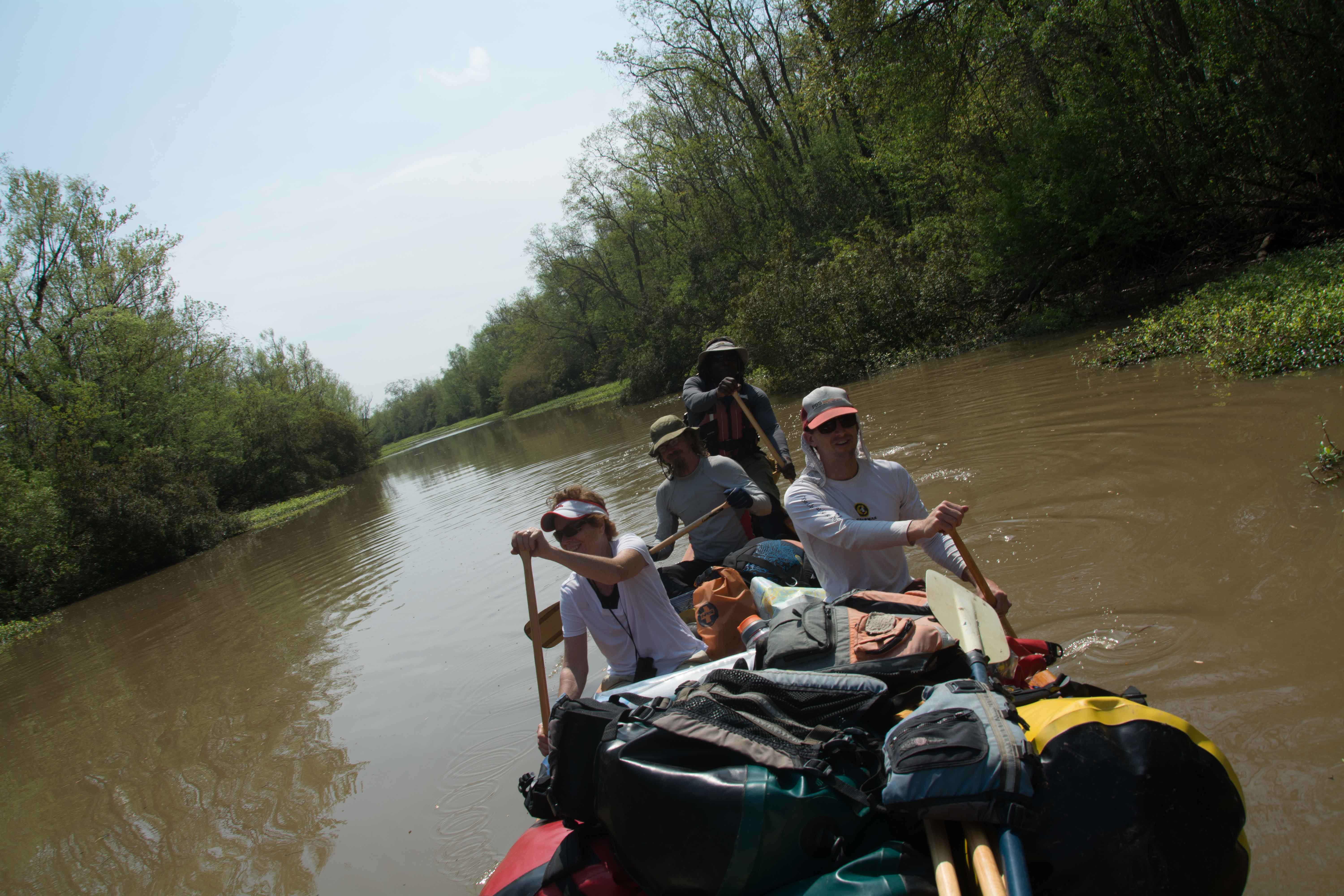
The Lower Mississippi River Water Trail

Services for Lower Mississippi River Paddlers

Vicksburg to St. Francisville:

Fortunately for paddlers on this stretch of river, you have the nearby presence of big river guide Adam Elliott.  Adam is based in Natchez at the Quapaw Canoe Company Natchez Outpost, and provides expert services for anyone paddling through this entire region, including guiding and outfitting, meals and shuttle.  Call Adam 601-807-5382 or send an email adam.elliott@island63.com, or go to www.island63.com and click on the Natchez section for more info.  Adam can meet you just about anywhere in between Vicksburg and Baton Rouge, and answer your questions and provide expert big river guiding (as well as shuttles, or equipment) with a smile and endless stories about the ever fascinating, mysterious big river.


St. Francisville to Baton Rouge:

For shuttles, resupplies, parking your vehicle, and logistics on the Lower Mississippi River, contact Baton Rouge natives Paul or Michael Orr.  While doubling as the Riverkeepers for the bottom end of the biggest river in North America, these two good hearted gentlemen have been providing support services for decades on the Lower Mississippi River, and are the experts on the stretch downstream from St. Francisville to the Gulf of Mexico.  Contact Paul Orr: paul@lmrk.org (225) 300-3902, Michael Orr michael@leanweb.org (225) 803-2999.

Lower Mississippi and Ohio River Forecast

You can forecast water levels on the Atchafalaya by watching the Mississippi River water levels, which can be seen at:  http://www.srh.noaa.gov/lmrfc/?n=lmrfc-mississippiandohioriverforecast.


The Lower Mississippi and Ohio River Forecast is a fascinating document and will reveal many qualities of the river to the careful reader and interpreter of this gauge.  You can also jump from this page following its links to many associated NOAA pages full of useful information about the various Lower Mississippi River Gauges, as well as historical records, flood records, low water occurrences, observed precipitation throughout the valley, snowpack, ground saturation, rain forecasts, and other meteorological and hydrologic aspects leading to current river conditions and accurate predictions.  You can also follow links to the same for readings and predictions from the Ohio River Valley, the Middle Miss, Upper Miss and Missouri River Valleys, which all of course confluence and combine to form the big waters of the Lower Mississippi River.

Reading Google Maps

You can learn a lot about the Mississippi River using Google satellite maps, bearing in mind certain parameters.  Firstly the Google map-images were recorded from space during a season of low water, hence the islands and sandbars are at their largest, and many back channels that are open at higher water levels appear to be closed.  Unlike highways which don’t change shape or position with the seasons, the islands of the Mississippi River and their back channels are dramatically affected by water levels.  And so the paddler needs to remember that the shapes of low-lying landmarks like the sandbars and wetlands seen on Google Satellite Maps or Google Earth is probably not what they are like on any given day when you are out on the river.  Be forewarned not to assume that the perfect-looking sandbar you see on you iPhone will be there!


Secondly, river levels change with the Google Maps zoom.  Take Choctaw Island for example.  When you go to Satellite view for the Mississippi River near Arkansas City you will see that Google employs various depictions of Choctaw Island.  (I have created map at:  http://g.co/maps/wmese)  Use the zoom tool to change scale.  Pay attention to scale icon at bottom left.  At zoom 1″ = 1 mile and above you can see the back channel partially open & flowing well.  The water level is probably around 3AG.  However change the zoom to 2″ = 1mile and lower you will see the back channel almost completely occluded by sandbars.  The water level in this depiction is certainly -4AG or lower.


Thirdly, for amorphous locations like river confluences and shifty river islands, what’s seen on Google Terrain may not be what’s seen on Google Satellite.  The maps from the mouth of the Arkansas are a good case in point.  Click on the map I created for the Mouth of the Arkansas Round Trip http://g.co/maps/syhs8   Look at it in Terrain, and then go to Satellite.  You will see that the Arkansas River channel occupies different channels!  This is not a mistake on Google’s part.  What you see in Terrain is from the 1972 USGS survey.  Since then the Arkansas has chosen a new path and carved out a new confluence location two miles from the older one.  This is the nature of this ephemeral river-scape.  It will be interesting to see how the current Arkansas River channel changes in the upcoming years, and how Google will keep up with it.

Lower Mississippi River Mileage

Mileage indicates miles above the “Head of Passes,” the ground zero of the Mississippi River, the fork in the road 10 miles below Venice and 90 miles below New Orleans where the Mississippi splits into its Delta channels as it pours into the Gulf of Mexico the three primary channel being the Southwest Pass, the South Pass and the Pass L’Outre.  All mileage between Cairo and the Caribbean is measured on this scale, starting with th Head of Passes at mile 0, Pilot Town at mile 3, Venice mile 10, New Orleans 95, Baton Rouge 230, St. Francisville 265, Natchez 363, Vicksburg 437, Greenville 537, Helena 663, Memphis 737, Caruthersville 846, New Madrid 889, and Ohio River 954.   The mouth of the Ohio River at Cairo Illinois is mile 0 for the Middle Mississippi (180 miles upstream to the Missouri River Confluence) and mile 982 for the Ohio River (up to Pittsburgh).

Rivergator

The title Rivergator is derived from the national best-seller The Navigator first published in 1801 by Zadok Kramer, with 12 subsequent printings.  The Navigator described the Mississippi Valley for pioneer settlers streaming out of the Eastern United States in the first great wave of continental migrations that eventually led to the settling of the Wild West.  Thomas Jefferson and other leaders were fearful that the French or the English would get there first.   With the Lewis & Clark explorations and the introduction of the steamboat to the Mississippi River in 1812, Americans followed the big rivers up and down through the heart of the country, and The Navigator was their guide.  In this spirit I have adopted the name Rivergator with the hope that Americans will rediscover their “wilderness within,” the paddler’s paradise created by the Lower Mississippi River.  And that the Rivergator will be adopted by successive generations of canoeists and kayakers, and re-written as the river changes.  Zadoc Cramer also invented the numbering system for Lower Mississippi River Islands, a system that survive to this day.

Towboat Protocol

Towboats are paddler’s most dangerous hazard.  Towboats can’t stop easily, and they often can’t see you.  But the good news is they move slow (10-14mph) and their motions are usually predictable.  In general upstream towboats seek slow water and downstream seek fast water.  The most dangerous place around any tow is in front of the tow.  It is usually safe anywhere behind their route of travel.  Never try to outrun a tow, and never paddle across their line of travel.  Carry VHF marine radio and monitor channel 13 for  traffic in the nearby vicinity.  For more information, go to: https://www.rivergator.org/paddlers-guide/safety/

Leave A Comment

SECTION MILE ACCESS CITY
Middle Mississippi & Bluegrass Hills / Bootheel 195-0, 954-850 ST. LOUIS TO CARUTHERSVILLE
Chickasaw Bluffs 850 – 737 CARUTHERSVILLE TO MEMPHIS
Upper Delta 737 – 663 MEMPHIS TO HELENA
Middle Delta 663 – 537 HELENA TO GREENVILLE
Lower Delta 537 – 437 GREENVILLE TO VICKSBURG
Loess Bluffs 437 – 225 VICKSBURG TO BATON ROUGE
Atchafalaya River 159 – 0 SIMMESPORT TO MORGAN CITY
Atchafalaya Upper
Consider The Atchafalaya  
The Atchafalaya  
Alternate Route To The Gulf Of Mexico: The Atchafalaya River  
Big Geography Geography  
Atchafalaya Exit  
Intro: Atchafalaya River  
The Atchafalaya River: Best Route To The Gulf  
Best Water Levels To Paddle To The Gulf  
Traffic And Industry On The Atchafalaya  
NOTE TO PADDLERS:  
Who Is The Rivergator Written For?  
Reading The Rivergator:  
Panel Of Experts:  
Wild Miles:  
Warning: Stay Away From Intake Canals!  
What Are The Wild Miles?  
Big Trees And Floodplain:  
Important Note To Paddlers:  
Your Route: Main Channel Vs. Back Channel  
The Atchafalaya Split  
Maps And Mileage  
USACE 2012 Atchafalaya River And Outlets To Gulf Of Mexico  
Louisiana Geological Survey Atchafalaya Basin Map  
Maps Of The Atchafalaya Delta  
River Speed and Trip Duration  
Dangers Of Paddling Through Morgan City  
Expert Paddlers Only!  
Wind Direction And Speed  
Atchafalaya Delta Tides  
Tidal Influence:  
Estimate Your Camp Height  
Tidal Coefficient  
Tides In Rivers  
Tidal Bore  
Water Speed In The Passes  
Which Pass?  
Wax Lake Outlet: Alternate Route To The Gulf  
Shell Island Pass  
Location Island Pass  
Amerada Pass  
Main Channel: Melanie Island  
The Joy Of Reaching The Gulf  
Camping On The Gulf At The End Of The River  
The Best Gulf Beaches  
Open Water Of The Gulf?  
Some Helpful Hints:  
Getting Back To Land  
Getting Back  
Upstream Paddling  
What Do You Do Now With Your Vessel?  
LiNKS = Leave No Kid On Shore  
Atchafalaya Basinkeeper  
Bayou Teche Experience  
Bayou Sara kayak Rental  
Pack & Paddle  
Services For Lower Mississippi River Paddlers  
Lower Mississippi And Ohio River Forecast  
Reading Google Maps  
Lower Mississippi River Mileage  
Rivergator  
Towboat Protocol  
What To Pack:  
Atchafalaya Swamp Pack List:  
Primitive Camping In The Marshes & Swamps  
Biting Bugs  
Poison Ivy  
Can You Drink The Water?  
Where Do You Go? (To The Bathroom?)  
Water Quality  
The Atchafalaya Basinkeeper  
The Lower Mississippi Riverkeeper  
Environmental Reporting Phone Numbers:  
Maps And Mileage  
Louisiana Geological Survey Atchafalaya Basin Map  
Atchafalaya River Boat Ramps (Functional Jan 2016)  
River Gages  
Best Water Levels To Paddle To The Gulf  
What Do You Do Now With Your Vessel?  
LiNKS = Leave No Kid On Shore  
Left Bank And Right Bank  
Towboats And Buoys  
VHF Marine Radio  
Resources  
Cajun Culture And The Atchafalaya Wilderness  
SOLA Coffee Companies  
How To Brew A Great-Tasting Pot Of River-Rat Coffee  
The Atchafalaya  
A Note On Mileage  
A Note On Pronunciation  
Where To Start Your Atchafalaya River Expedition  
Leaving The Mississippi River  
Mississippi River Maps And Mileage  
NATCHEZ GAGE (NG)  
WATER LEVELS AND DIKES  
USING THE NATCHEZ GAGE:  
Three Inflow Openings At Old River  
Warning  
Old River Control Structure: 3 Inflow Channels  
316.3 RBD Hydro Inflow Channel
313.7 RBD Knox Landing
311.7 RBD Auxiliary Intake — Old River Control Structure
316.3 RBD Hydro Intake — Old River Control Structure
Short History Of The Old River Control Structure  
314.6 RBD Main Intake — Old River Control Structure
313 LBD Buffalo River
Clark Creek Natural Area  
311.7 LBD Clark Creek
311.7 – 310 LBD Tunica Hills Below Clark Creek (Mississippi Loess Bluffs ##6)
311 – 309 RBD Point Breeze
310.2 LBD Wilkinson Creek
306 LBD Welcome To Louisiana!
306 – 294 LBD Angola State Penitentiary
306 LBD Angola Ferry
304.5 – 303 LBD Shreve’s Bar
306 – 302 Back Channel Of Shreve’s Bar
306 – 302 Main Channel Of Shreve’s Bar
303.8 Old River Lock And Dam: Entrance To The Atchafalaya River
Leaving The Mississippi Towards Lock & Dam  
The Atchafalaya River: Best Route To The Gulf  
How Does A Lock & Dam Work?  
Contact Lockmaster  
Safe Paddling Through A Lock & Dam  
Lock Signals  
Inside The Lock Chamber  
Order Of Locking Through  
Mileage Down Lower Old River Channel  
6.9 RBD Three Rivers Junction
Red River  
Three Rivers WMA And Red River NWR  
Atchafalaya – A Modern History  
Atchafalaya Lower
Atchafalaya River Basin Biotas  
A Lived-In Landscape  
Atchafalaya Mileage  
RBD = Right Bank Descending, LBD = Left Bank Descending  
Gas Pipelines  
Simmesport Gage (SG)  
Water Levels According To The Simmesport Gage  
Maps And Mileage  
USACE 2012 Atchafalaya River And Outlets To Gulf Of Mexico  
Louisiana Geological Survey Atchafalaya Basin Map  
0.1 LBD Three Rivers Landing
1.4 LBD Small Dune
1.9 RBD Coville Bayou
3.4 LBD Bayou Coteau
4.5 Simmesport KCS Railroad Bridge
4.6 LBD Simmesport Sand Dune
4.8 LBD Kuhlman Bayou
5.5 Simmesport River Park
Simmesport, Louisiana  
Canadaville, Louisana  
9 – 11 RBD Odenburg Island Dikes
12.5 LBD Marine Bayou
13 – 20 Atchafalaya Squiggles
13.2 RBD Porcupine Point
14.5 LBD Cypress Point
14.5 RBD  
14.7 RBD Small Dunes
15.5 Primitive Boat Ramp (Private)
16 RBD Eddy Dune
16.5 RBD Trash Site
17 – 18 RBD Hick’s Landing/Gordon Point
18 – 20 LBD Bayou Point
Borrow Pits And Blue Holes  
20.5 LBD Small Sandy Shelves
20 – 25 Bayou Current To Elba Landing
22 RBD Cell Tower
22.2 LBD Small Hump Of Sand
23.4 RBD Barberton Landing
25.1 RBD Elba Landing
26.1 RBD Small Bluff Of Sand
26.2 LBD Broad Sandy Shelf
26.3 RBD Old Channel Of Bayou Rouge
27.1 LBD Point Coupee/Bayou Latenache Pumping Station
27.1 Morganza Floodway – North End
28.1 Underwater Pipeline Crossings
28.2 Aerial Pipeline Crossing
29.6 Melville Union Pacific Railroad Bridge
29.7 RBD Melville Boat Ramp (Primitive)
29.8 LBD Melville Ferry Barge East Bank Landing
30 – 40 Melville To Krotz Springs
31 LBD Broad Bay
31.5 LBD Cross Bayou
31.7 LBD Open Field Cow Pasture
32.5 LBD Cross Bayou Point (Owl Hoot)
35.6 LBD Small Sandbar
36 – 37 RBD Sandy Landings
37.1 RBD Cell Tower
39.7 LBD Bayou Sherman Point
Atchafalaya Basin Pack List For Swampy/Marshy Camp Sites  
Switching To The KROTZ SPRINGS GAGE (KG)  
Water Levels According To The Krotz Springs Gage  
38.5 – 42.7 Krotz Springs Utility Crossings
39.3 Water Drainage Structure: Origins Of The Teche River
39.5 RBD Cell Tower
39.6 LBD High Sand Dune
40.3 RBD Gravel Landing
40.3 Wire Suspension Bridge For Pipeline
41 Krotz Springs US Hwy 190 And 71 (2 Bridges)
41.5 Krotz Springs Union Pacific Railroad Bridge
42.3 RBD Krotz Springs Boat Ramp
Krotz Springs History  
42.5 RBD Port Of Krotz Springs
Krotz Springs To The Split  
Atchafalaya National Wildlife Refuge  
44 Sherburne Bend
44.5 RBD Frank Diesl Point
44.9 LBD Small Sand Dune
46.1 RBD Bayou Big Graw Boat Ramp
49.3 RBD Bayou Courtableau
49.7 LBD Coswell Point
51 RBD Courtableau Point
54.2 LBD End Of The East Bank Levee
55 LBD Atchafalaya NWR Boat Ramp
55.1 Two Blue Holes
55.4 LBD Alabama Point
56.4 RBD Old Atchafalaya Point
56.4 The Atchafalaya Split
Whiskey Bay Pilot Channel  
59.8 I-10 The Atchafalaya Basin Bridge
60 RBD Sand Dune
60.5 Union Texas Petrochemical Aerial Crossing
61.7 LBD Bayou Des Glaises Boat Ramp (Primitive)
62.3 LBD Bayou Des Glaises
66.4 RBD Splice Lake
66.7 LBD Pat’s Throat
68 RBD Willow Point
68.5 LBD Blue Heron Point
70.9 LBD Upper Grand River
73.4 LBD Little Tensas Bayou
75.3 LBD Texaco Resources Dock
75.5 RBD Splice Island (Bottom End)
Primitive Camping In The Marshes & Swamps  
75.7 LBD Jake’s Bayou
75.8 Three Major Pipelines
76.4 LBD Lake Mongoulois Point
77.2 RBD Bayou Chene
79.9 Tarleton Bayou
81.2 LBD Bayou Sorrel
81.2 LBD Bayou Sorrell: Alternate Route Down The Atchafalaya
3 Days On Dean’s Route  
East Grand Lake  
82.4 LBD Bee Bayou
82 – 99 Chicot Pass
83 Pipeline Tailings
83.2 Philip’s Canal
85.7 RBD Danbury Management Corp Dock
86.2 RBD Canal Entrance
86.8 RBD Canal Entrance
88.1 RBD Canal Entrance
89.7 RBD Pipeline Canal
91.2 Texas Gas Transmission Co. 12″ Gas Pipeline
Attakapas Island Wildlife Management Area  
95.4 LBD Blue Hole
96.1 Texas Gas Transmission Co. 12″ Gas Pipeline
96.7 Old Pipeline Canal
97.3 Louisiana Intrastate Gas Corp 4″ Gas Pipeline
98.2 RBD Myette Point
MORGAN CITY GAGE (MCG)  
Water Levels According To The Morgan City Gage  
Tidal Influence  
Estimate Your Camp Height  
100.2 LBD Blue Hole Landing
102 RBD Sixmile Lake: Access To Wax Lake Outlet
Wax Lake Outlet: Alternate Route To The Gulf  
Paradise Regained: The Wax Lake Delta  
103.8 LBD Narrow Bayou Leading To East Grand Lake
105 LBD Blue Point Chute: Shortcut To Cypress Wonderland
107.9 Exxon Gas Transmission Company 20″ Gas Pipeline
108.3 RBD Shortcut To Sixmile Lake
109 RBD Cypress Pass Back Channel
109.5 Duck Lake Channel
Duck Lake  
Many Rivers To Follow  
111.7 RBD Lower Atchafalaya River
111.7 RBD Riverside Pass
112.5 RBD Three Island Pass
113 RBD Little Island Pass
Main Channel Atchafalaya River  
115.1 American Pass
115.8 LBD Pipeline Canal To Dog Island Pass And Flat Lake
Flat Lake  
115.8 – 119.8 LBD Drew’s Island
117 RBD Stouts Point
119 Drew’s Pass
Dangers Of Paddling Through Morgan City  
Waves  
Small Tows In Harbors  
Towboats Vs. Tugboats  
Stay Off The River In Fog  
Fleeted Barges  
Buoys And Other Hazardous Stationary Objects  
119 LBD Swiftships Boat Yard
119.5 RBD Bayou Teche (Berwick) Lock & Dam
119.5 RBD Bayou Teche Water Trail
121 Morgan City US Hwy 90 Bridge
121.2 LBD Morgan City Downtown Landing
Morgan City  
121.3 Morgan City Texas And New Orleans Railroad Bridge
121.4 RBD Berwick Public Boat Ramp
121.4 LBD Mr. Charlie: The International Petroleum Museum
Intro: Morgan City To The Gulf Of Mexico  
Maps Of The Atchafalaya Delta  
Best Water Levels To Paddle To The Gulf  
Morgan City Gage (MCG)  
Water Levels According To The Morgan City Gage  
Flood Stage Warning:  
Weather And Tides  
Check The Winds And Weather  
Tidal Influence:  
Estimate Your Camp Height  
121.5 LBD Gulf Intracoastal Waterway (East)
121.7 – 130.3 Bateman Island
Pipelines And Electrical Lines  
124.2 RBD Berwick Intracoastal Waterway Boat Launch
124.2 RBD Gulf Intracoastal Waterway (West)
124.5 RBD Gulf Intracoastal Waterway Point (South Side)
Atchafalaya Delta Navigation Channel Buoys  
126-127 LBD Outside Bend Highground
127.4 Bateman Island Point And Bend
127.5 – 128 RBD Cypress Forests
128 – 131 LBD Sweetbay Lake
131 LBD Access To Bayou Shaffer Via Sweetbay Lake
131 RBD Glass Island
Night-Time Sky In The Atchafalaya Delta  
131.8 – 132 LBD Stands Of Young Cypress Trees
134 RBD Sandy Willow Spit
134 LBD Avoca Island Cutoff
135-136 LBD New Dike Wall
135-138 LBD New Navigation Channel Around He Avoca Island Bend
136 – 137 Sandy Marsh Island
137.8 RBD Shell Island Pass
Gulf Route: Crossing Over To The Wax Lake Delta  
Atchafalaya Delta Wildlife Management Area  
138.5 LBD Low Lying Muddy/Sandy Beach With Willows
139.1 LBD Small Shell Beach
140 LBD Deer Island
140.5 RBD Breaux’s Pass
140.2 LBD Location Island Pass
142.2 LBD East Pass
144.2 RBD Amerada Pass
144.2 RBD Willow Island
144.3 LBD God’s Island
144.8 RBD Log Island Pass
145.4 RBD Yvette Island
146 RBD Melanie Island
148.5 RBD Donna Island
150.5 RBD Eugene Island
151.5 LBD Bird Island East
Pount Au Fer/Raqet Pass  
Getting Back To Land  
Atchafalaya Delta WMA Campground  
Wax Lake Delta Passes  
Getting Back  
Upstream Paddling  
What Do You Do Now With Your Vessel?  
LiNKS = Leave No Kid On Shore  
Louisiana Delta 229 – 10 BATON ROUGE TO VENICE
Birdsfoot Delta 10 – 0 VENICE TO GULF OF MEXICO